Flooding Andrew Marvell’s Hull in VR

Funded by XR Stories/ Arts and Humanities Research Council, this 2019-20 project was led by Dr Stewart Mottram at the University of Hull. Mottram and an interdisciplinary team of environmental specialists worked with digital partners, BetaJester Ltd, to recreate in virtual reality one well-documented historical flood of Hull from 1646-47. The project used immersive storytelling to foreground historical flooding and help raise awareness of flood risks today.
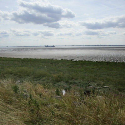
The City of Hull is recognised internationally for its vulnerability to flooding from rising sea levels and was one of five global cities selected in 2018 by The Rockefeller Foundation for the City Water Resilience Framework. It is vital that communities and businesses in at-risk regions like the City of Hull and Humber estuary become more aware of and adaptive to future flood risks.
How can we harness the power of the environmental humanities – of environmental histories and literatures – to help build resilience to future flooding?
Hull has an 800-year history of living with water risks, and there are several major floods recorded in the archives of the city and region, including a well-documented flood event in winter 1646-47. By drawing on the records of the 1646-47 flood and combining expertise across the humanities and environmental sciences, this project used digital technology to create an immersive and interactive encounter with the story of the 1646-47 flood. The project aimed to show how estuary cultures like Hull learned to live with flooding in previous centuries, and to foreground how flooding has shaped the literature and culture of regions that continue to live with flood risk today.
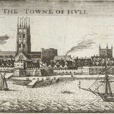
In order to recreate the 1646-47 flood of Hull we first built a digital model of the seventeenth-century town and surrounding terrain. Basing our model on Wenceslaus Hollar’s scaled map of Hull from c.1640, we used Arc-GIS to georectify and digitise Hollar’s map, adding terrain data (from the Ordnance Survey and LIDAR), and gauge data from recent storm surges in Hull, both adjusted for seventeenth-century sea levels.
We sourced building, wall, and revetment dimensions from standing buildings, archaeological reports, and archival accounts of Hull’s early modern flood defences.
We then applied the open-source CAESAR-LisFlood landscape evolution model to our digitised Hollar map, creating time-stepped simulations of the 1646 storm surge and flood path. These simulations were then validated against historical accounts and animated in Unity VR by industry partners, BetaJester Ltd.
Finally, we used these animations to create an immersive and interactive VR experience, in which visitors to the VR storyworld are immersed in the experience of the 1646-47 flood, guided by Hull poet and politician, Andrew Marvell (1621-78), author of the poem ‘To his Coy Mistress’, written around the time of the winter flood of 1646-47 and featuring flooding ‘by the tide of Humber’.
In the storyworld, Marvell prompts users to make decisions about flood mitigation measures like raising or lowering sluice gates. We consulted with secondary school teachers in the Hull and Humber region and ran pilot workshops with schools to ensure the suitability of the Rising tide of Humber storyworld for education audiences.
To find out more about the Rising tide of Humber project and how to collaborate with us, please contact Stewart Mottram